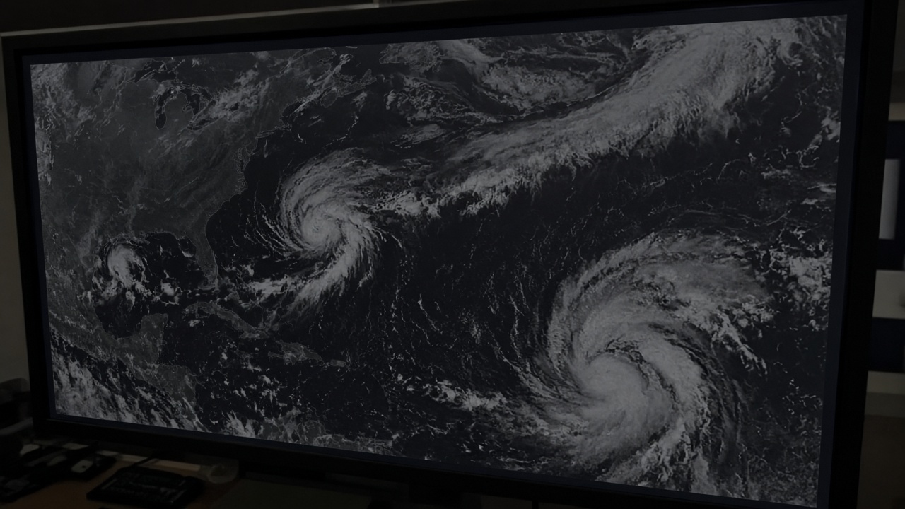
The National Hurricane Center said Wednesday that two tropical disturbances in the southwest Atlantic—designated Invest 93L and Invest 94L—each have high odds of becoming tropical cyclones within days, while private meteorologists warned that a rare Fujiwhara dance between the systems could determine whether the eastern United States faces direct landfall impacts or a prolonged inland flood threat starting this weekend.
What forecasters see on the water
Neither invest was a named storm as of Wednesday morning, but NHC outlooks gave both areas elevated formation chances as they meandered in warm September waters. Hurricane specialists said 94L is the more likely U.S. threat, while 93L could curve north and tease Bermuda—but the pair's relative strength and track may hinge on the Fujiwhara effect, in which two cyclones orbiting close together exchange momentum and can deflect each other's paths.
Houston-based meteorologist Matt Lanza wrote in his Eyewall newsletter that forecasters may be "watching these systems for the next week," cautioning that even a weaker offshore 94L could still interact with an upper-level cutoff low over the Tennessee Valley to pull deep tropical moisture into the Carolinas, southern Appalachians, and parts of the Mid-Atlantic.
Flood risk without a direct hit
Former NHC hurricane specialist Bryan Norcross noted in public briefings that landfall is not required for a serious flood episode: persistent onshore flow ahead of a slow-moving disturbance can dump rainfall measured in double-digit inches on saturated Piedmont soils still recovering from prior summer storms. Emergency managers in North and South Carolina began pre-positioning swift-water teams and reviewing dam inventories, standard moves when long-range models show a moisture pipeline rather than a tight landfall cone.
Retailers along the coast reported upticks in generator and plywood sales, though hardware chains said traffic remained below major-hurricane panic levels because NHC had not yet named either invest. Insurance adjusters watch Fujiwhara setups closely after past seasons in which a weaker second storm steered a stronger one into unexpected landfall points.
Shutdown season overlap
The timing collides with Washington's looming Sept. 30 funding deadline. Federal emergency planners said NOAA weather forecast operations are expected to continue during a lapse, but FEMA resilience grants and flood-insurance policy issuance could stall if Congress misses a stopgap—complicating preparedness for communities that might need NFIP coverage before heavy rain arrives. The National Flood Insurance Program's authorization also expires Sept. 30, meaning new policies could not be written during a lapse even as existing claims would still be paid from available funds.
State officials stressed that county emergency operations centers, not federal payroll status, drive first-hour evacuations. Still, mayors from Charleston to Norfolk said they were briefing staff on dual-track contingencies: storm landfall and federal funding uncertainty.
What to watch next
NHC will issue more frequent outlooks if either invest organizes. The key variables are whether 93L strengthens enough to shove 94L westward, and whether an inland cutoff low amplifies rainfall regardless of coastal wind speeds. For now, the bulletin is meteorological, not operational: two invests with high development odds, a possible Fujiwhara twist, and an inland flood scenario that could begin this weekend even if beaches see only gusty squalls.
For the environment desk, the new fact is the pairing—twin Atlantic invests under Fujiwhara scrutiny at the height of hurricane season, with forecasters emphasizing water over wind for the Carolinas.