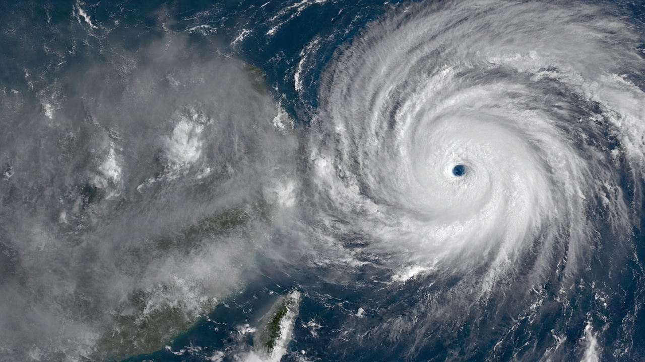
Taiwan's Central Weather Administration moved Surigae from mild to moderate typhoon status at 8 p.m. on Sept. 26, and by the following morning the system was still forecast to curve away from the island. The more locally consequential line in the same bulletin was quieter: the northeast monsoon is expected to arrive around Oct. 1, dragging cooler, wetter air across the north for the first three days of the month.
A category change that did not change the track
CWA issues routine bulletins at fixed synoptic hours, and the 20:00 slot on Sept. 26 is where Surigae crossed the threshold. Under the agency's own scale, the upgrade is arithmetic: intensity categories are assigned from the 10-minute average wind speed near the storm center, with the moderate band sitting above the mild ceiling. A category change describes the storm's internal energy, not its direction.
Forecast guidance across Sept. 26–27 kept the center on a path away from Taiwan, so the practical risk stayed maritime — sea conditions for fishing boats and ferry routes — rather than a landfall scenario. That distinction shapes how the weekend should read: an upgraded typhoon that does not arrive is still worth watching, but it does not reorganize anyone's Monday.
The heat before the rain
The Sept. 27 forecast put western Taiwan near 36°C, a late-season heat signature that stands in sharp relief against what comes next. CWA's call for Oct. 1 marks the start of northeast monsoon flow, and with it cooling rain across the north into Oct. 3. That is the real transition on the calendar — the point where the island's weather stops being governed by tropical systems and starts being governed by the winter pressure pattern.
What a monsoon onset claim actually is
An arrival date is a judgment call, not an instrument reading. Monsoon onset is diagnosed from a sustained wind shift plus a change in moisture transport, and operational forecasters apply threshold criteria to decide when the pattern has flipped rather than simply wobbled. The revised bulletin places that flip near Oct. 1, which is a statement about the large-scale circulation, not about any single rainy afternoon in Taipei.
That is also where the limits sit. Five days out, the onset signal competes with ordinary variability: a front can pass, rain can fall, and the wind field can still fail the criterion. The Oct. 1 date will be judged after the fact by whether the wind and moisture fields actually hold.
What would replicate in a Taiwan lab
A group at Academia Sinica's Research Center for Environmental Changes, or an atmospheric science lab at NYCU in Hsinchu, could rerun onset detection against reanalysis and ask how many ensemble members place the transition on Oct. 1 rather than Oct. 2 or 3. The sample questions are the ones that apply to any forecast issued this far out: how many members, how much spread, and does the criterion fire on a genuine circulation shift or on a single wet day?
For the typhoon itself, the comparable question is structural. Category upgrades are a proxy for the wind field near the center, and a system moving away from land offers little ground truth unless buoys or ships happen to sample it. Taiwan's dense land-based network does not reach the center of a storm that stays offshore, which is precisely why the marine advisories matter more than the headline category.
How to read the next five days
For readers in Taipei and the north, the useful sequence is straightforward: hot through the weekend, umbrellas from Oct. 1, and a genuine step down in temperature into midweek. For the south and west, Surigae remains a coastal and maritime note, with the tide watch running through Sept. 30 on its own lunar schedule. The intensity headline is real. The forecast that changes daily life is the one dated Oct. 1.