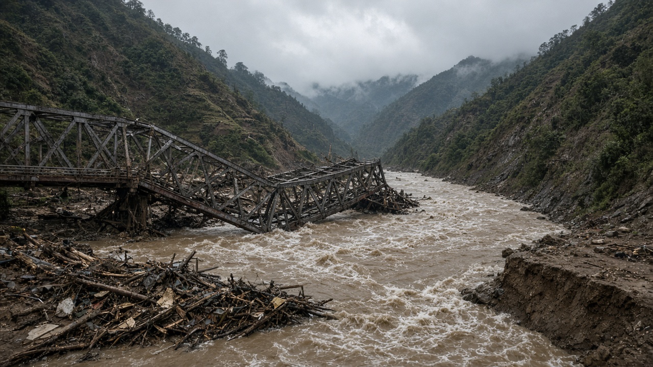
A torrent of mud and boulders tore through settlements along Nepal's Budhigandaki River on Sunday, washing away motorable bridges, suspension footpaths, and a landmark cantilever crossing that had kept high-mountain villages linked to the outside world. Authorities said on Monday that at least 45 houses were destroyed and 27 more damaged in Chumnubri and neighbouring wards, while five people remained missing and an unknown number of foreign trekkers were stranded on trails that no longer exist.
What triggered the surge
Nepal's National Disaster Risk Reduction and Management Authority said the flood was not driven by heavy rainfall alone. Preliminary assessments point to a landslide that blocked the Ungilung stream, a tributary feeding the Budhigandaki. When the blockage gave way, water and debris slammed into the main river channel, sending the level from roughly 3.66 metres at 6:30 a.m. to 8.43 metres by 8:40 a.m. on Sunday — well above the five-metre danger mark at monitoring points that were themselves swept away.
The event lands barely six weeks after glacier-linked flooding on another Himalayan tributary killed more than 1,400 people near the Nepal–Tibet border. Sunday's disaster was smaller in confirmed casualties but wider in infrastructure loss across Gorkha district, where trekking routes toward Manaslu and Tibet depend on fragile river crossings.
Bridges and power projects gone
Police and local officials counted two motorable bridges, two suspension bridges, and three hydropower projects damaged, along with 34 livestock sheds. The steel span at Soti, linking wards of Arughat Rural Municipality, vanished entirely. On the Dhading side, 22 metres of reinforced concrete on the Arughat crossing were ripped away, though engineers told the Department of Roads that a Bailey bridge might be feasible atop surviving truss work.
Perhaps the most symbolic loss is the 90-metre cantilever bridge at Sardibhir, built with British aid after the 2015 earthquake. Deputy chair Laxmi Gurung of Chum Nubri Rural Municipality told reporters the structure was Nepal's second cantilever span and the only year-round foot connection between Chumchet and Chhekampar without cliff-hanging rope routes. "The route will have to be rebuilt from scratch," she said.
Rescue limits and stranded visitors
With northern Gorkha's road and trail network severed, settlements are leaning on helicopters for evacuations and supplies. The Kathmandu Post reported that tourists visiting the region were stuck at lodges because footpaths to lower valleys disappeared under landslide rubble. Five-megawatt and smaller hydropower camps along the river were damaged, cutting local electricity just as cold weather approaches the high valleys.
Prime Minister KP Sharma Oli's office said disaster-response teams were en route, but cloud cover and continued instability along the riverbanks slowed reconnaissance. The full toll may rise once satellite imagery and ground teams reconcile reports from Machhakhola, Ghattekhola, and Jagatbagar, where mud buried ground floors wholesale.
What officials are watching next
Scientists at the disaster authority stressed that a detailed geotechnical study is still underway to confirm whether Sunday's breach mirrored August's glacial outburst or stemmed from a fresh slope failure. Either way, the Budhigandaki corridor — already stressed by hydropower construction and trekking traffic — now faces months of Bailey-bridge shuttles and airlifted food.
For families who rebuilt once after 2015 and again after last summer's catastrophe upstream, the question is not whether aid will arrive from Kathmandu, but whether any bridge they erect next can survive the next blocked gorge. Until engineers publish a cause report, every thunderstorm in Syarkhola will be read as a warning.