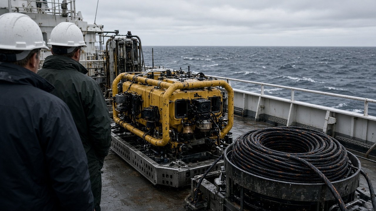
Scientists aboard a Japan Agency for Marine-Earth Science and Technology expedition used a remotely operated vehicle to pull mantle rock fragments from a Mariana Trench slope, samples that could refine models of how Pacific plates bend before they dive beneath the Philippines Sea plate.
What the ROV recovered
JAMSTEC's published cruise summary lists basalt and serpentinite chunks from a forearc site east of Challenger Deep, stored in nitrogen-flushed boxes for shore labs in Yokosuka. The ROV "Kaiko" successor class manipulator arms chipped boulders from outcrops rather than scooping loose sediment, preserving mineral textures geologists need for water-rock reaction studies.
Expedition leads said on-board sensors recorded temperature and salinity gradients as the vehicle ascended, pairing rock chemistry with fluid pathways. Japan Society for the Promotion of Science grants co-funded university postdocs who will run electron microprobe work at the University of Tokyo's Earthquake Research Institute.
Why mantle rock matters
Subduction zones generate Japan's earthquakes and tsunamis; hydration of mantle minerals influences how faults slip. Existing models rely heavily on ophiolite exposures on land and synthetic experiments. Fresh trench material tests whether those proxies match deep-ocean reality — especially for slow-slip events that stress Kanto preparedness offices.
International collaborators from the United States and Europe shared ship time under existing memoranda; sample splits will go to Oregon State and GEOMAR after Japanese priority windows close.
Technical hurdles
Mariana weather windows are narrow; the team lost two days to typhoon swells before deploying. ROV tethers stretched near their rated depth, forcing pilots to abort one dive when currents spiked. Recovery still beat the cruise plan's minimum sample count, a outcome JAMSTEC highlighted in its Monday press note.
On-deck handling followed biosafety-style chains of custody to avoid salt spray contamination. Crew photographed each fragment with scale bars for open-data archives — a requirement for JSPS-funded cruises since 2024.
Beyond pure science
Japan's marine technology exports include deep-sea vehicles and acoustic mapping packages; successful trench recoveries reinforce marketing for defense-adjacent seabed surveys, though this cruise was civilian. Cable companies routing fiber through Pacific corridors also watch fault hydration research for trench stability studies.
Public outreach events in Kanagawa next month will display resin-embedded thin sections, not raw rocks, to avoid handling injuries.
What happens in the lab
Researchers will measure hydrogen release during simulated subduction heating — experiments that take months. If results diverge from land-based ophiolites, earthquake simulators may adjust friction parameters. No immediate forecasting change is promised; science moves slower than headlines.
For now, JAMSTEC's ROV haul is a rare physical window into the mantle Japan sits above — rock that left the deep ocean so geologists can read the plate story in a Yokosuka lab instead of a textbook diagram.
Open data and classrooms
Cruise metadata and ROV track logs will enter JAMSTEC's public repository after a 60-day embargo, letting high-school earth-science classes plot dive paths against bathymetry maps. University partners pledged bilingual lesson plans for Okinawa schools that sit above the same subducting slab.
Future dives may target alternate trenches if weather cooperates; funding for a 2027 expedition is already in the science ministry's draft budget appendix, though Diet approval is never guaranteed until the ink dries.
Instrumentation aboard the cruise
Shipboard mass spectrometers ran preliminary scans before samples cooled, giving chemists a head start on hydration signatures. Magnetometers towed behind the hull mapped anomalies that might explain why certain outcrops fracture differently than land-based ophiolites suggest.
ROV pilots logged 14 hours on the bottom across four dives, approaching the upper limit of tether fatigue protocols; JAMSTEC rotates pilot teams every six hours to keep error rates low when manipulating fragile rock faces.
Earthquake science payoff
University of Tokyo collaborators will feed results into subduction-zone simulators used by the Earthquake Research Institute's public hazard maps. Changes, if any, will surface in peer-reviewed papers first — not in Monday headlines — but the sample set is large enough to settle a decade-old debate about serpentinite distribution near the trench axis.