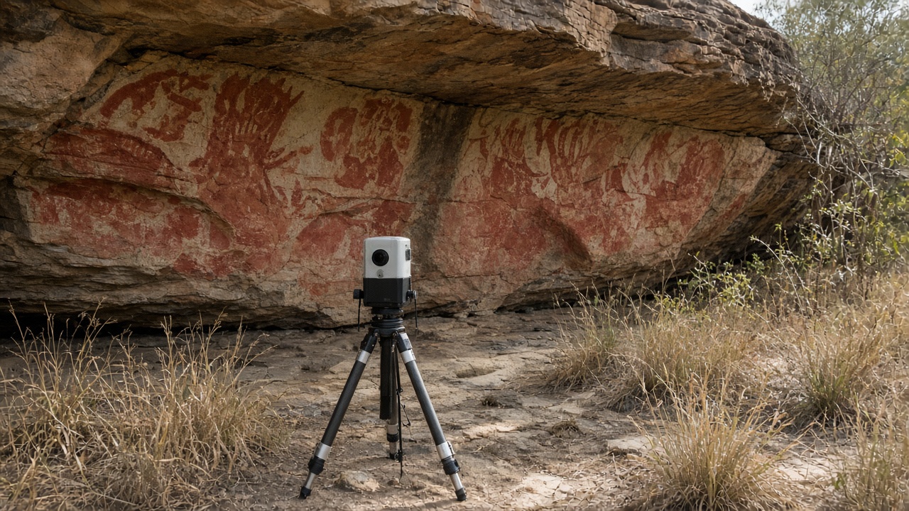
CSIRO scientists and Kakadu Traditional Owners published the first millimetre-scale laser maps of Danajaa shelter rock art on Friday, using a tripod-mounted lidar rig that never touched the ochre panels during a week-long field season in dry-season conditions.
The scans resolve finger-width strokes on kangaroo and barramundi figures estimated at more than 8,000 years old, detail that earlier photography flattened when sunlight raked across the cave mouth. Gundjeihmi Aboriginal Corporation elders said the digital twin will live on community-controlled servers, not open cloud buckets, and that access requests from researchers must pass a seasonal closure calendar that blocks visits during wet-season humidity spikes.
How the mapping worked
Engineers from CSIRO’s Mineral Resources division repurposed a mine-scanning lidar, slowing sweep speeds to avoid vibration that might flake fragile pigment. The team worked only in mornings before heat haze distorted returns, and they powered equipment from silent battery packs after birds nested near the shelter entrance. Each scan merged with colour photographs shot under diffused LED panels tuned to spectra that elders approved after test shots on replica boards.
Unlike earlier chalk-outline documentation banned decades ago, the lidar captures relief on repainted layers, showing where newer white figures overlay older red strokes. Archaeologists said that stratigraphy helps date occupation phases without scraping samples for radiocarbon work unless custodians grant separate consent.
Why it matters for preservation
Kakadu rock art faces smoke from managed burns, tourist humidity, and occasional vandalism. Digital baselines let rangers compare future scans for millimetre-scale flaking after extreme wet seasons linked to climate change. Parks Australia said it would not use the data to increase daily visitor caps at nearby public sites; the mapped shelter remains off the tourist trail.
The method may expand to other estates if communities invite teams. CSIRO posted its processing scripts under a licence that prohibits commercial tourism apps from republishing coordinates, responding to past incidents where geotagged photos led to unauthorised visits.
University of Wollongong rock art specialists who peer-reviewed the dataset said the lidar mesh will also help rangers plan where to install passive humidity loggers without drilling into sandstone. Those sensors feed alerts when cave microclimates shift enough to threaten pigment binding, a problem that accelerated after record wet seasons in 2023 and 2024.
Parks Australia confirmed funding for two ranger trainees from the Gundjeihmi community to learn scan processing in Darwin, part of a broader push to keep digital heritage skills on country rather than outsourced to southern consultancies.